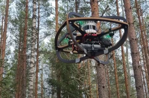
It is no secret that drones are quite handy for exploring remote and hard to access areas. This video from Kostas Alexis shows drones performing under-canopy navigation, exploration and mapping in dense forests. A learning-based navigation approach was used that calculates collision-free actions without access to any form of consistent map. The below videos shows how it works:
More like this ➡️ here
Autonomous Under Canopy Navigation and Mapping in Dense Forests (DigiForest @ Evo, Finland)
[HT]
*Our articles may contain aff links. As an Amazon Associate we earn from qualifying purchases. Please read our disclaimer on how we fund this site.


![DJI Drone Changing a Light Bulb [Video]](https://www.roboticgizmos.com/wp-content/uploads/2024/11/25/DJI-Drone-Changing-a-Light-Bulb-238x178.gif)


